Cape Breton Topographical Relief
Created 1 months ago
Remixed 2 times
Description
A stylized, stepped topographical relief map of Cape Breton Island. The model features distinct elevation tiers to represent the Highlands, the Craignish Hills, and the East Bay Hills, along with cutouts for the Bras d'Or Lake system.
- Stepped Terrain: Five elevation layers representing the island's topography.
- Offshore Islands: Includes St. Paul Island, Scatarie Island, and Isle Madame.
- Display Base: Mounted on a rounded rectangular plaque with engraved title text.
Images
More like this
Explore more in Decor & Display →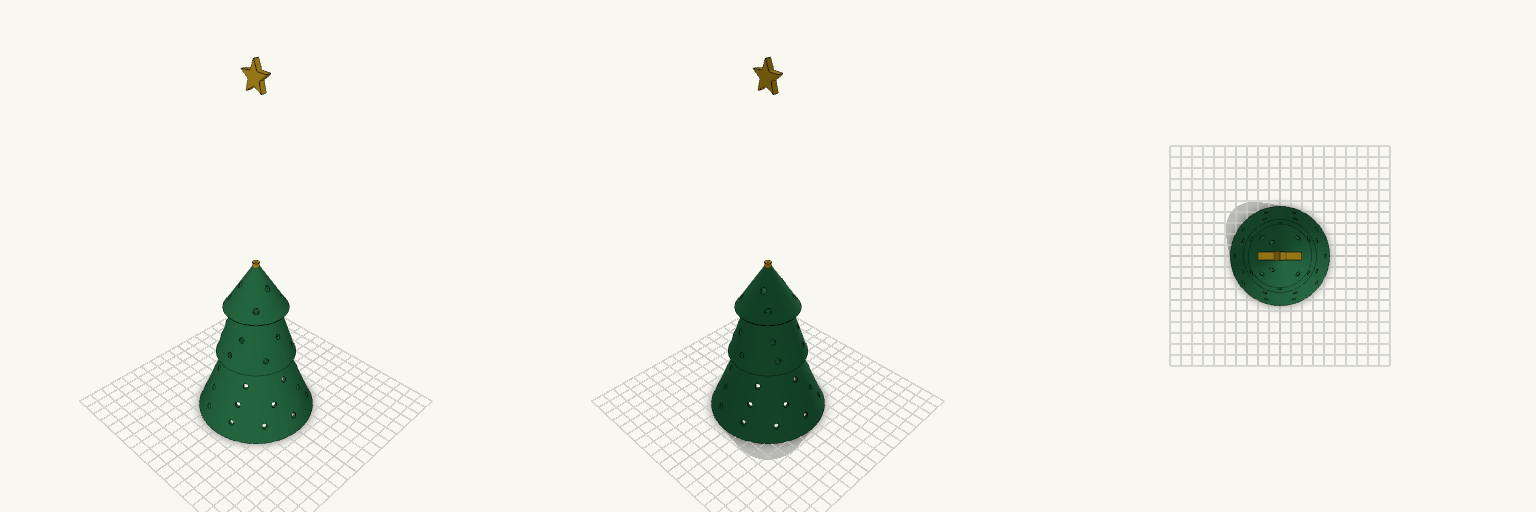
Christmas Tree Lantern for LED Tealight
A Christmas tree lantern that sits over a battery LED tealight, so the light stays hidden inside instead of glaring from a bare tealight on the table. The walls are perforated with rings of small round holes that throw dots of light, and the bottom is open so the LED can be placed or swapped without taking anything apart. Key numbers Height: about 135 mm including star Base diameter: 90 mm, open underneath (inner opening about 87 mm) Wall: 1.6 mm, three stacked tiers Perforations: 4.2 mm holes, staggered rings Star: separate colour, peg-mounted into the top tier Printing Print upright, open end down, no supports needed for the cone walls Green for the tree, gold or yellow for the star Use a 0.4 mm nozzle; a lighter or translucent filament glows more
Moldura A4 Vertical 250 × 337 mm, Fundo Aberto
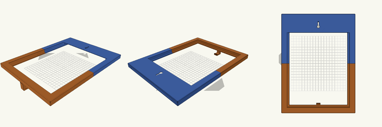
Moldura para folha A4 (210 × 297 mm) na vertical, em duas metades unidas por pinos-guia, com a folha entrando por uma fresta na travessa superior. Medidas Externo: 250 × 337 × 15 mm Abertura visível: 202 × 289 mm, lábio frontal de 5 mm Bolso do papel: 212 × 299 mm Fresta superior: 206 mm de largura Fixação e encaixes 4 pinos-guia de Ø5 × 8 mm na metade superior, com alojamentos de Ø5,6 mm na inferior Keyhole para prego: entrada de Ø10 mm e fenda de 4,2 mm, na travessa traseira superior Gancho na borda inferior frontal Verifique antes de imprimir Cada metade mede 250 mm de largura, acima dos 220 mm de uma impressora comum. A traseira é aberta abaixo da travessa do keyhole, então nada segura a folha por trás. Não serve para papel muito fino ou ondulado.
Lamp Bases, Shades and Diffuser Set
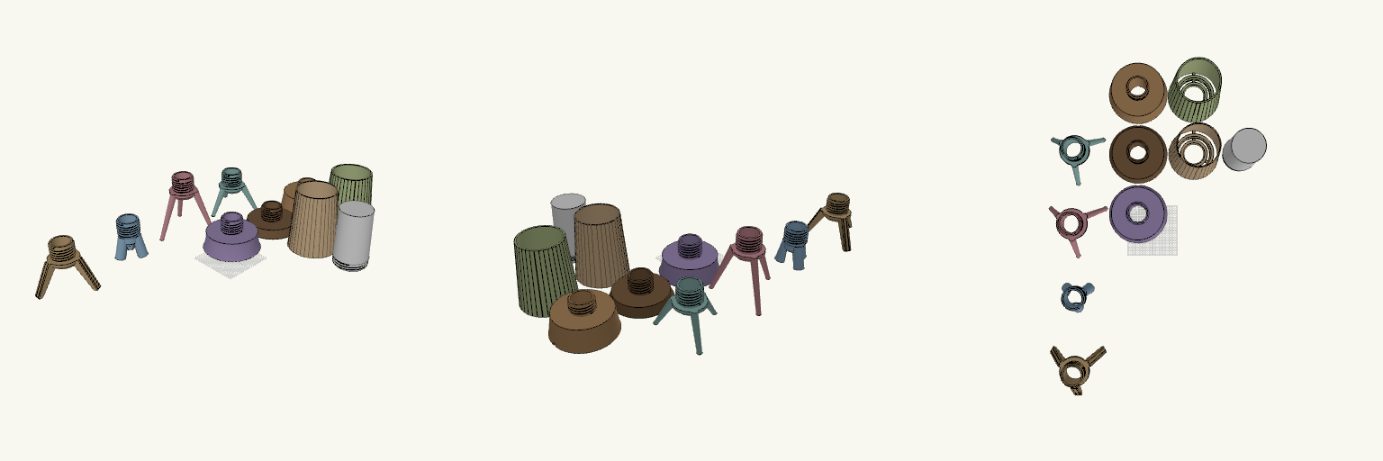
A set of mid-century lamp parts that all share one coarse 6 mm-pitch thread, so any shade fits any base. The set has two fluted shades (round and square ribs), a white adjustable diffuser and several bases: tall, short, grooved, two tripods, a flat-leg grooved tripod and a dowel-leg hub. Remix hooks Flat-leg tripod: legs are 16 mm wide slabs (before scaling) with two grooves, 3.2 mm wide, down each outer face. Change the groove count, offset (±4 mm) or width. Leg height and spread: hub height 70 mm and foot radius 70 mm set the splay. Raise both for a taller version. Thread spigot: 52 mm across, 38 mm long. Keep it to stay compatible with the shades. Pairs with: either fluted shade and the diffuser. The 42 mm bore runs straight through for the bulb and cord.
Soporte de tarjetas con estrella grabada
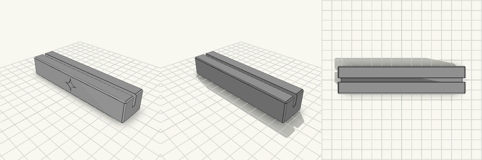
Bloque rectangular con una ranura central para tarjetas y una estrella de cuatro puntas con lados curvos, grabada hacia el interior de la cara frontal. Bloque de 115 x 25 x 20 mm con bordes achaflanados Ranura de 4 mm de ancho y 10 mm de profundidad, de extremo a extremo Estrella curva de 16 mm de punta a punta, hundida 1,5 mm y centrada en la cara frontal Se imprime sin soportes apoyada sobre su base
Hexagonal Honeycomb Floating Shelf Set
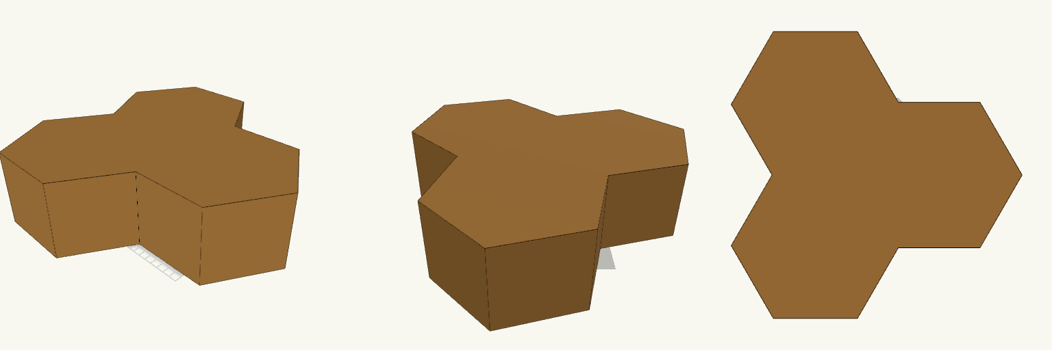
A three-cell honeycomb of hexagonal wall shelves, each cell deep enough for small plants or a few books. The cells share walls and mount as one cluster, so a blank wall becomes a single graphic statement. Two keyhole slots per hex are hidden in the back panel, so no brackets are visible once hung. What it's for Displaying small potted plants, books, or ornaments on a wall. Turning a plain wall into a honeycomb feature without visible hardware. Hanging flush: screw heads sit in recesses on the wall side of the 6 mm back panel. Dimensions Each hex: 200 mm across the points, about 173 mm across the flats. Depth: 100 mm per shelf. Back panel: 6 mm thick. Side wall: 5 mm. Keyholes: two per hex, 80 mm apart, cut through the back panel with a recess on the wall side. Layout: three hexes joined along shared walls in a triangular cluster. Print notes The cluster is oriented back-down on the build plate, so it needs no supports. It prints as one large fused piece. Check that it fits your bed, or split it into single hexes. Use screws with heads that fit the keyhole recess, and anchors suited to your wall type. Remix ideas Add more cells to extend the honeycomb sideways or upward. Change the depth for shallow trinket shelves or deeper book cubbies. Print each hex separately in different colours and assemble them on the wall. Add a lip or a drainage hole for planters.
Fireplace Advent Calendar, Printable Multi-Piece
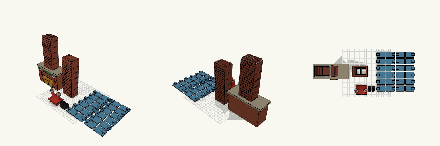
What it's for A 24-day advent calendar styled as a brick chimney on a fireplace. Pull a day's divider and the prize drops down the flue into the firebox. Santa is stuck at the top. Dimensions Two chimney sections, split at 204 mm 12 levels with 2 compartments each, 20 mm clear height 24 flat dividers and a separate Santa Removable firebox filler, 60 mm wide, with pull tab and break-away nubs. It leaves open gaps at the sides and clears the firewood. Remix ideas Change the garland to lights or holly Add a name or year to the mantel Resize the compartments for larger prizes